
Stepping Off Shore and into Sea Country
Along the Australian coast, tens of thousands of years’ worth of Indigenous history lies a short dive below the sea’s surface. The hard part is finding it.
Article body copy
When one-third of the Australian continent was submerged, ancestors of the world’s oldest living cultures were there to see it. Lands that once were wide open to exploration and home to many people flooded as the ocean crept inland following the last ice age, some 10,000 years ago. Traces of human occupation vanished underwater. Aboriginal people living at the farthest reaches of Australia’s ancient coastline would have steadily retreated; those living inland would have witnessed the sea transforming their country. In Murujuga—once an interior rocky mountain range and now a coastal archipelago and peninsula in Western Australia—ancient people recorded the sea change in stone through artworks depicting newly arrived marine life and other animals, now extinct.
Today, Murujuga stands as one of the largest collections of ancient rock art in the world. The million-plus engravings, which date back more than 40,000 years, are accompanied by evidence of human occupation scattered along the present-day coast, an archaeological record like no other. “That says something for how significant this particular site is,” says Peter Jeffries, CEO of the Murujuga Aboriginal Corporation (MAC), which represents the five language groups in the area, and has about 1,200 members, though the community is bigger than that.
There’s excitement anew in Murujuga. Two more ancient archaeological sites were found—underwater—in 2019, and reported in 2020. They date back to 7,000 and 8,500 years ago, when water inundated the dry land where they sat. They are the first submerged sites of Aboriginal cultural heritage found on Australia’s exceptionally broad continental shelf.
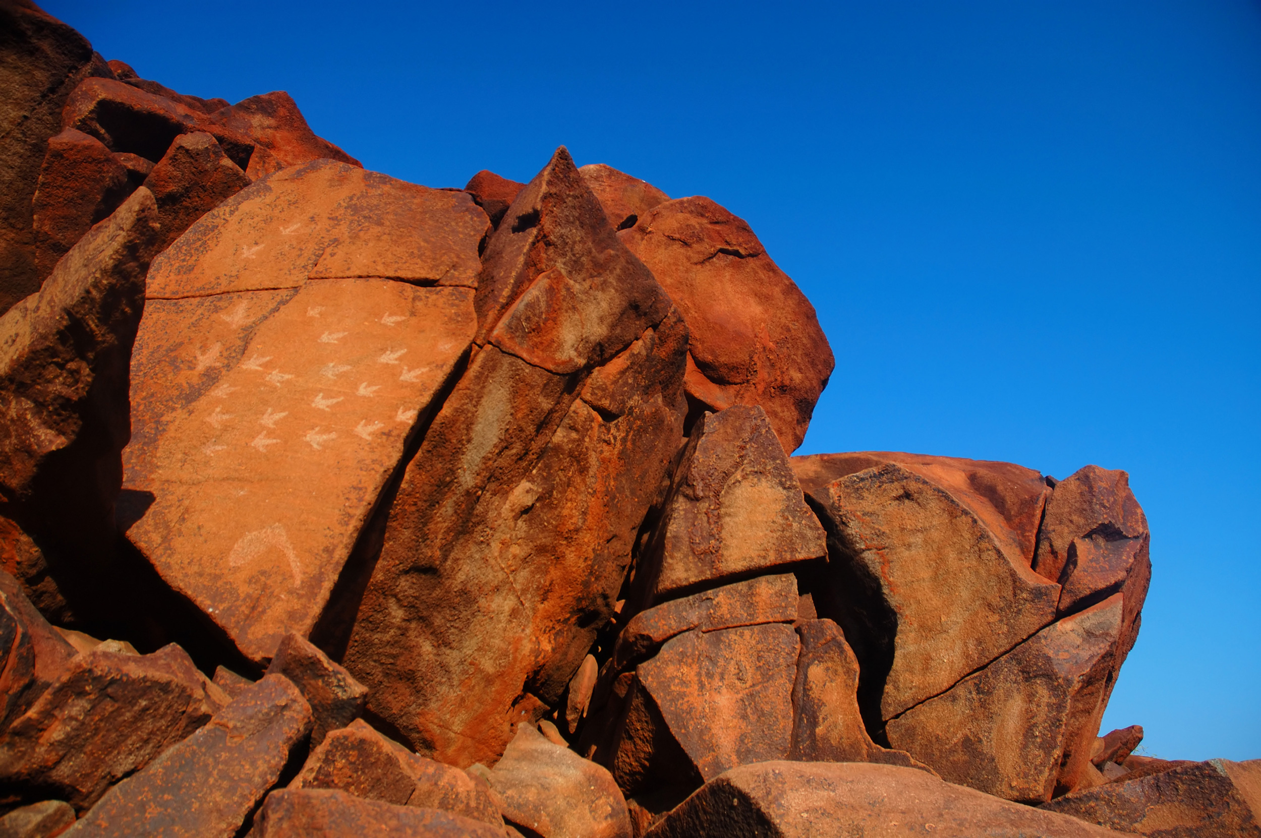
The Burrup Peninsula in Australia contains one of the largest collections of rock art in the world. The engravings found there date back more than 40,000 years. Photo by Suzanne Long/Alamy Stock Photo
Archaeologists believe that these underwater sites are just the first of many; there could be millions more artifacts out there on the seabed. Around two million square kilometers of land around Australia was lost to rising seas after the last ice age, about the same area as modern-day Mexico. The scientific thinking echoes Indigenous lore: that these now-submerged landscapes, often called sea country, hold some of Australia’s oldest histories.
And so, the ocean beckons. Excited by the potential of uncovering ancient pasts, researchers and traditional custodians in Australia and beyond are stepping offshore to delve deeper into Indigenous histories, in search of sites that probably would have been destroyed or eroded if they lay on dry land. “You mustn’t stop at the shoreline,” says archaeologist Jonathan Benjamin, who steered the project in Murujuga. But when venturing into unknown waters, the search begins close to shore.
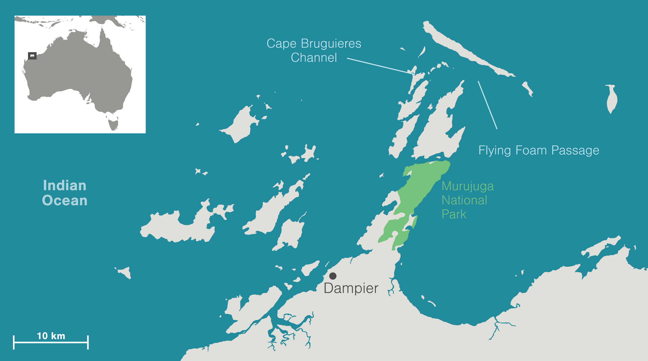
Murujuga—translated as “hip bone sticking out”—is a place few Australians have visited, and most might not even know about. On the far northwest coast of Australia, the red, rocky Burrup Peninsula juts into the sea from the port town of Dampier. Together with the surrounding islands of the Dampier archipelago and the waters in between, this is Murujuga country, as it’s known in the local Ngarluma-Yaburara language.
With its magnificent rock art collection and a coastline marked with remnants of long-ago industry—quarries for making stone tools, stone traps for catching fish, and mounded shell middens—Murujuga is clearly attractive to curious archaeologists. If you had to choose somewhere in Australia to step offshore, this would be it, says Benjamin, who had his sights set on the country’s continental shelf when he took his position at Flinders University in Australia in 2014. The archipelago, Benjamin says, is full of nooks and crannies, bays and straights, inlets and sea caves—all with gentle waters that could protect artifacts hiding beneath the surface. If archaeologists were to find anything underwater, it would be here.
Map data by OpenStreetMap via ArcGIS
In 2017, Benjamin launched the project, which entailed several field expeditions over three years. Jeffries matched the research team’s fervor with his patience. His people have always known there would be relics of their ancestors hiding out on the seabed, he says; it was just a matter of time until they were found.
“Where the land is currently located is not where we always lived,” Jeffries says, echoing the stories told by elders. Looking west from Murujuga toward the Indian Ocean some 20,000 years ago, the coastline would have been far out of sight, roughly 160 kilometers from where it rests today, and most likely home to some of Australia’s first inhabitants.
As far as records go, the earliest evidence of Aboriginal occupation in Australia dates back 65,000 years with stone tools found at a rock shelter on the tip of the Northern Territory—an almost 3,000-kilometer drive from Murujuga—a part of the country that was once connected to its northern neighbor, New Guinea, forming a prehistoric landmass. But, of course, as with any archaeological site, the rock shelter represents just a fraction of the country’s Indigenous history. There’s much more to the story, and it likely rests offshore. If found, such sites could allow archaeologists to retrace Aboriginal peoples’ earliest steps across the continent, while also providing tangible evidence for Aboriginal people to use in protecting the submerged lands where their ancestors once walked.
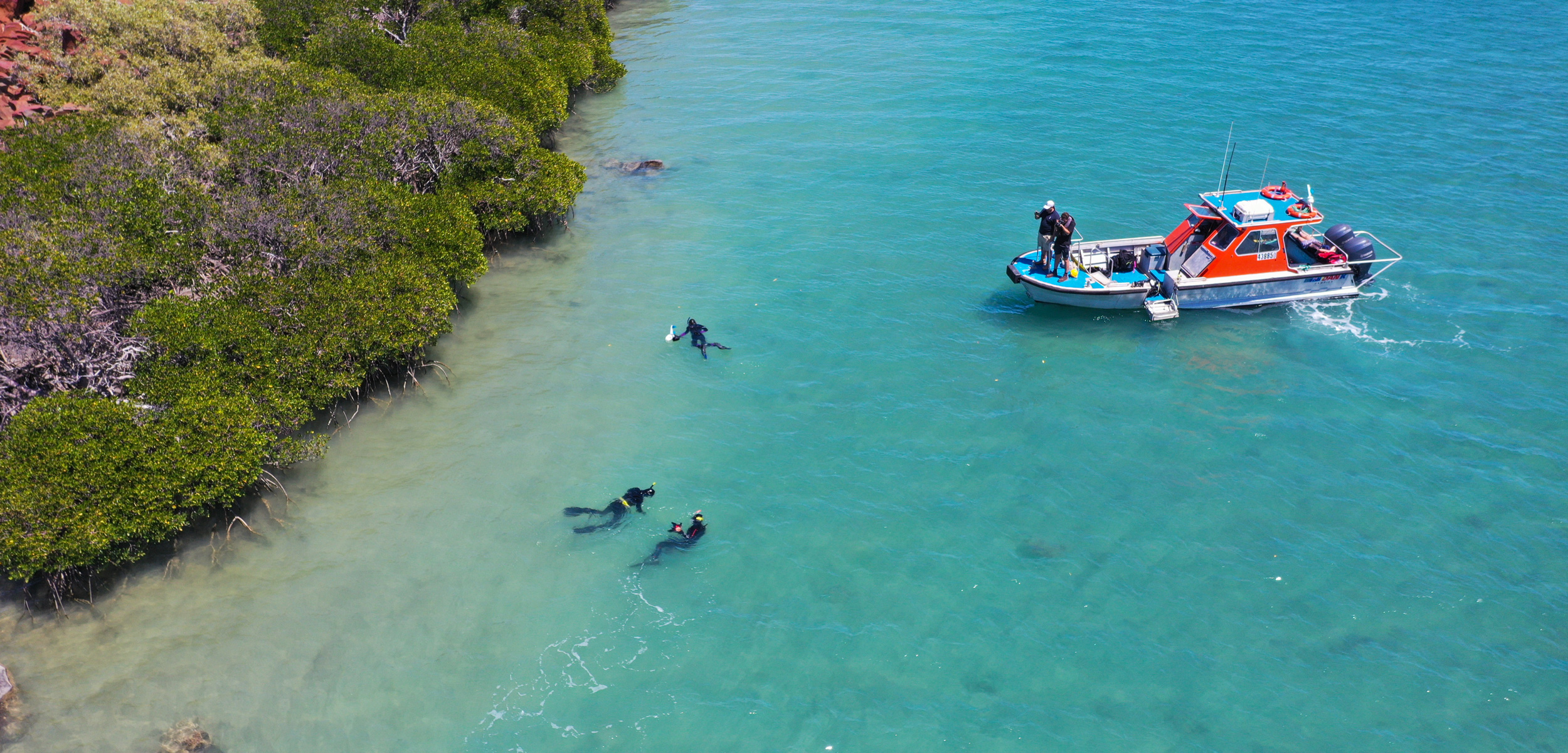
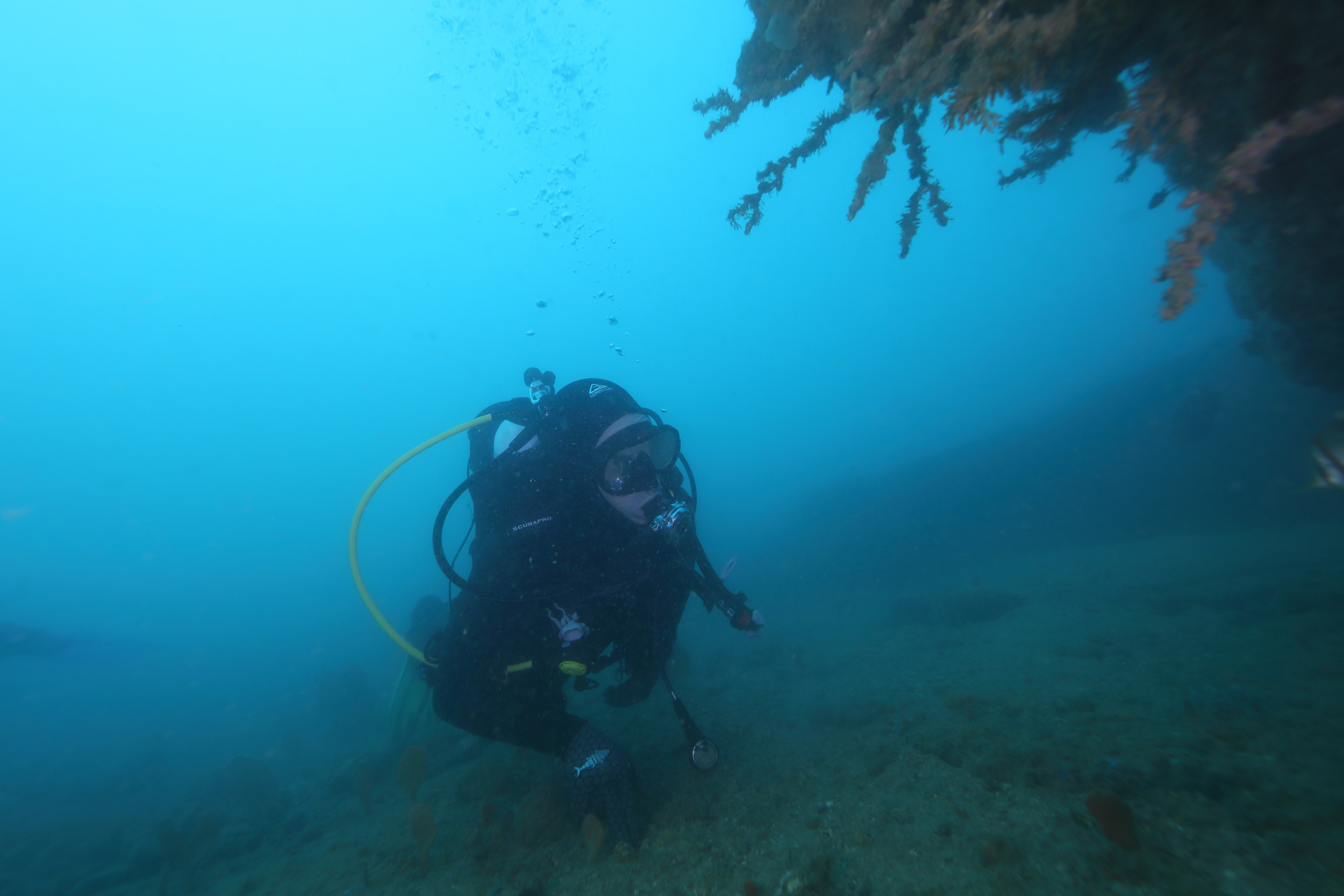
The search for ancestral lands in Murujuga began with the researchers seeking permission from Murujuga’s traditional custodians. With their permission, Benjamin’s team studied the shoreline and then ventured into the sea to look for promising underwater landmarks for their dive team to investigate—an old riverbed, a valley, a shoreline.
The crew snorkeled in front of stone quarries and fish traps dotted across the intertidal zone, and diving archaeologists surveyed the sometimes rocky, usually silty, slopes below. They imagined the seabed as dry, consulted satellite images and nautical charts, and filled in the gaps of existing maps. Broad strips of the underwater landscape were imaged with airborne lasers, while the finer features of the seabed were captured with sonar, its high-frequency sound pulses bouncing between the researchers’ boats and the seafloor.
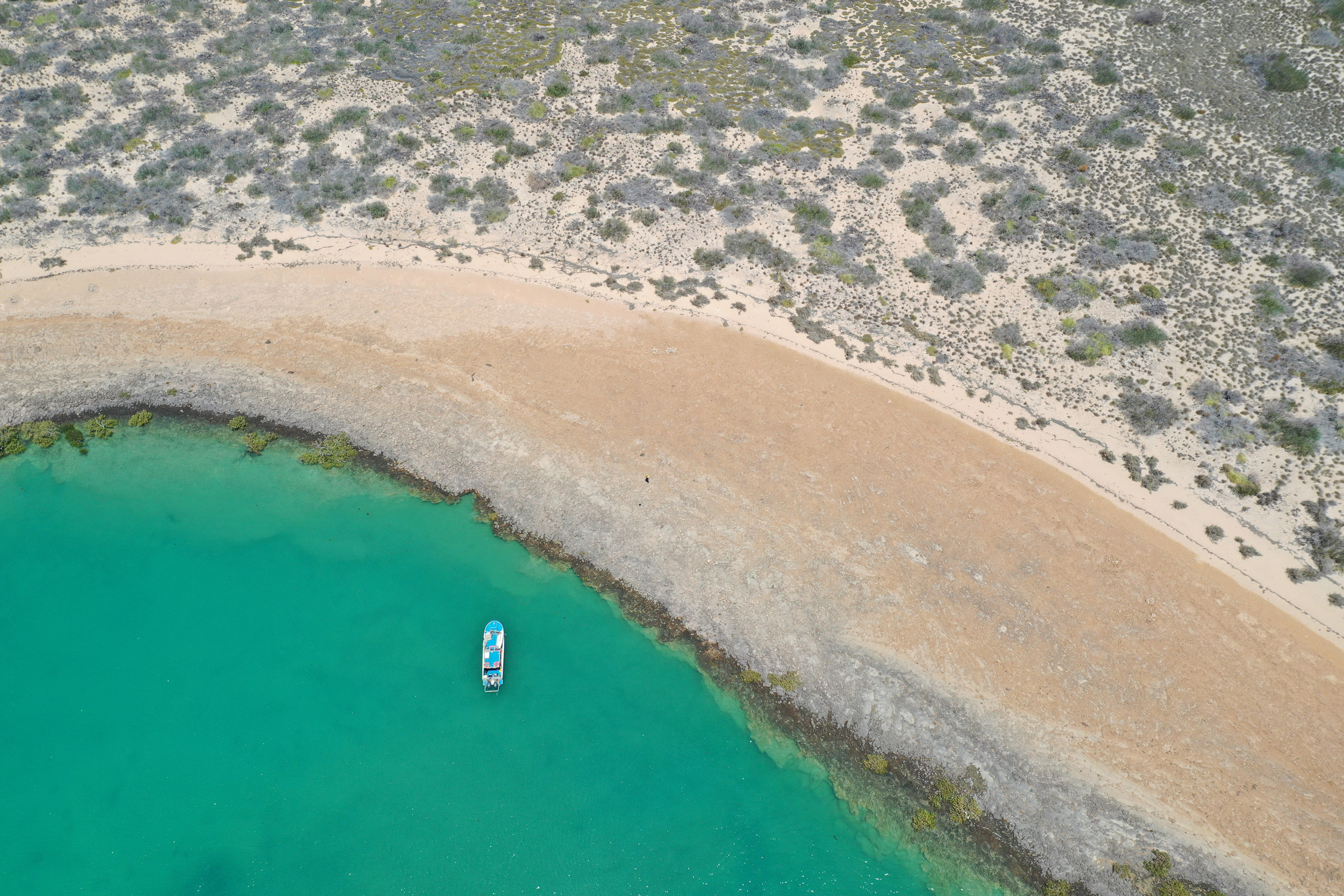
Australia’s long, shallow continental shelf makes searching for archaeological features more feasible than searching in coastal areas that are narrow and steep. Photo courtesy of the Deep History of Sea Country Project
These remote-sensing technologies were useful in Murujuga, but the team knew they needed more than technology to hone their search. So they also asked local divers, skippers, and fishers—people who know the ins and outs of the archipelago—about special geographic features in the area. Murujuga’s traditional custodians pointed out important sites, too. “Those casual chats can lead to a collection of hard data at some point,” helping to inform the next steps in a project, Benjamin says.
In fact, one of the two sites where the team found stone artifacts was in a channel fishers knew as a good fishing spot, called Flying Foam Passage. Fish congregate there because of what’s colloquially known as a wonky hole—a place where a freshwater spring full of nutrients seeps out of the seabed, attracting scores of fish. To archaeologists, a submerged spring could indicate the remains of an ancient river or a billabong where people may once have congregated and perhaps left their mark. Sonar identified a sunken hollow in the seabed, roughly half a kilometer offshore, so the divers went to investigate. They weren’t disappointed.
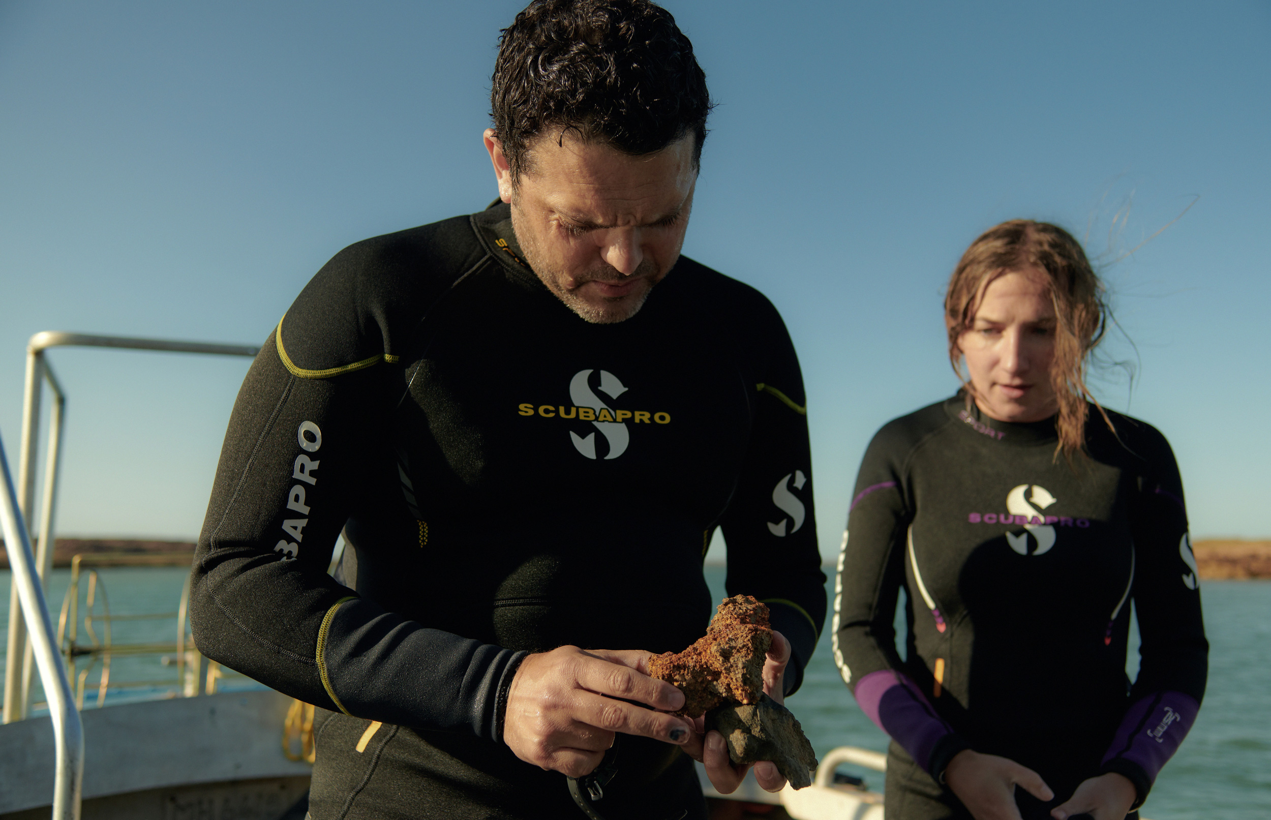
On their final day of diving at Flying Foam Passage, the team found a single stone tool near the wonky hole. The artifact was nestled in the rocky seabed so far offshore and in currents so weak that it couldn’t have washed in from elsewhere. Its sharp edges had also not been flattened or damaged, which might have happened had the tool tumbled offshore. But it hadn’t. By reconstructing past sea levels at its exact position, the researchers deduced that the sea swallowed this artifact 8,500 years ago or more.
Project leader Jonathan Benjamin and graduate student Chelsea Wiseman were part of a team that scoured the seabed in areas once dry in search of artifacts. Photo courtesy of Sam Wright/the Deep History of Sea Country Project
If that weren’t enough, a sizable collection of barnacle-encrusted stone artifacts, 269 in total, was also found nearby, in Cape Bruguieres Channel, on the archipelago’s northern side. Like the Flying Foam Passage tool, the researchers noted that the stones retained sharp edges, plus they were strewn across the seabed, not swept in by tidal currents. The artifacts are also distinctly different in shape and size to others found previously on land, indicating they were crafted at an earlier time.
While the stone artifacts discovered underwater at Murujuga are a first for Australia, archaeologists elsewhere have been exploring drowned landscapes for decades now, in search of deeper histories.
Plotting the rise and fall of sea levels across geological ages to identify archaeological sites on ancient shorelines was a strategy applied over 20 years ago on the other side of the Pacific Ocean, in the bays of Haida Gwaii, an archipelago off British Columbia. Many coastal sites situated on Haida Gwaii’s modern-day shores or farther upslope have been identified in the process. But to go further back in time, into the late Pleistocene, archaeologists knew they must venture deep underwater using sonar and remote-controlled submersibles. In 1999, Daryl Fedje, an archaeologist with Parks Canada at the time and now at the Hakai Institute, and his colleagues scooped up a 10,000-year-old stone tool just 10 centimeters long from a drowned coastal plain now 53 meters below sea level. Like Murujuga’s traditional custodians, the archipelago’s Indigenous people, the Haida, were not surprised by this find; it was simply a physical mark of their enduring presence on the islands.
Archaeologists think that future finds along the continent’s watery fringes could enrich our understanding of human occupation of the Americas further still and add to studies of human migration. Knowing the movements of people around Haida Gwaii, and along the length of North America’s Pacific coast, can offer more evidence that the first people followed the coastline or took to the seas as they migrated south from Beringia, the ice-age landmass that connected North America to Russia. It could explain how humans reached Chile around 14,500 years ago—some research even suggests it was as early as 18,000 years ago—before the end of the last ice age. Archaeological sites preserved in the subtidal zone could also reveal more about the rich maritime customs of those first seafaring or coast-dwelling cultures.
Todd Braje, an archaeologist at San Diego State University is leading the seaward search around California’s Channel Islands. Nearly 100 sites with great antiquity have been found around the islands’ current coastlines, one as ancient as 13,000 years old, but earlier histories remain shielded by the sea.
Much like the team in Murujuga, Braje and his fellow archaeologists and marine geologists are tracing submerged landforms across the seafloor, aided by improved remote-sensing technologies that can delineate features of the seabed even when buried in sediment.
Around 8,000 years ago, this sea-logged spot was dry. Photo courtesy of the Deep History of Sea Country Project
To Braje, the reports from Murujuga are exciting because they demonstrate that careful predictive modeling of historical sea levels across submerged landscapes can lead researchers to underwater archaeological sites. However, Braje says, the technical challenges grow as archaeologists plunge deeper and farther offshore in many promising areas. The continental shelf along North America’s west coast is narrow and steep compared with Australia’s broad, flat underwater plain—not to mention North America having destructive wave forces and tectonic fault lines that may have erased whole swaths of the continent’s long-sought-after coastal archaeological record.
Unlike the physical calamities that destroy material remains, oral histories of Indigenous communities have remained relatively intact and rich in information. Australia’s ancient living cultures have their own perspectives of deep time, preserved in oral histories passed down through generations and reflecting an unwavering and deeply spiritual connection to their country, land and sea. Histories recall fish traps submerged, rivers drowned, and landforms created by rising seas.
Following this thread through deep time to the present day means that for many traditional custodians in Australia, the significance of the submerged sites found at Murujuga lies not necessarily in what the stone tools signify of the past, but rather, in what the sites signal for the future. The discovery confirms that there are significant cultural sites situated on the vast, relatively shallow lip that surrounds the sunbaked continent, and these can be found and recovered. It also affirms Aboriginal peoples’ contemporary connections to the sea, and underscores why sea country should be protected.
Since the last ice age, sea levels have risen 130 meters in Australia; researchers believe there are thousands more underwater archaeological sites to find. Photo courtesy of Sam Wright/the Deep History of Sea Country Project
Damage to archaeological sites in Murujuga is not a remote threat. Rock art sites have been destroyed before by industrial development on the Burrup Peninsula, and mining companies continue to operate shipping ports and processing plants despite their proximity to the exceptional art. The community and researchers worry that damage from gas and particulate emissions will further erode sites. Parts of Murujuga’s heritage are now protected as a national park—but it is still exposed to heavy pollution. And in the past, Peter Jeffries says that these heavy industries have dismissed the assertions of Murujuga traditional custodians that their cultural heritage could be found out to sea. Now, with the first artifacts found underwater in Murujuga, he hopes traditional custodians can leverage more meaningful negotiations with industry, to preserve their heritage on land and protect sea country, as well. Jeffries says the opportunity also goes beyond Murujuga and extends to other traditional custodians around Australia’s coastlines: “This [discovery] is not only for us.”
As soon as it was announced, the news from Murujuga resounded around the country, across to Cape York and down to Tasmania, the island that hangs off the southeast corner of the continent. In Tasmania, Emma Lee shares Jeffries’s hope for a future where sea country is afforded the same protection as the land.
Lee is a trawlwulwuy woman from tebrakunna country on the northeast coast of Tasmania. She exudes optimism but says the submerged sites in Murujuga highlight a problem for Indigenous peoples: policymakers view the land and sea as completely separate entities.
“We don’t see a disconnect between oceans and lands because we know that country and family, our ancestors, are out there,” says Lee, who trained in archaeology and is a research fellow at Swinburne University of Technology in Australia, focusing on Indigenous affairs, environmental policy, and governance. To Aboriginal people, country is kin and it should be cared for, and for saltwater people like Lee who reside on the coast, their stewardship stretches out into the sea.
Mapping submerged landforms can help Indigenous people find connections to country that may have been lost or fractured since colonization, says Lee, who is one of many holding onto her people’s oral histories of the Bass Strait flooding, which separated Tasmania from mainland Australia some 11,000 years ago: “[Those connections to sea country] were there and then they’ve disappeared; now they are revealed.”
All of which just goes to show how country has a life of its own, Lee says. And it’s possible that Murujuga sea country revealed itself to the world now to expand our understanding of what connection to country means for Indigenous peoples—and to show that stepping offshore and into the deep has its rewards, both tangible and intangible.